Distribution Map Generator
A QGIS plugin to batch create distribution maps.
This QGIS plugin generates a series of distribution maps based on a vector layer of point localities. It uses a chosen field in the localities attribute table to select matching features (presumably species), and intersects that with a separate vector layer which contains the grid polygons (these could also be other zonal vector layers, such as provinces or habitat types, or you could use the point layer itself to get point maps out). The selected points or polygons are then overlaid on the base map. Each distribution map is saved as a png file, with the unique identifier as a filename.
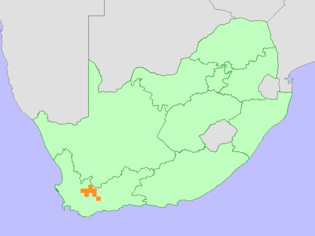
The following image shows a sample output map using a polygon grid layer:
You can also use the same localities point layer as the overlay to get a point distribution map:
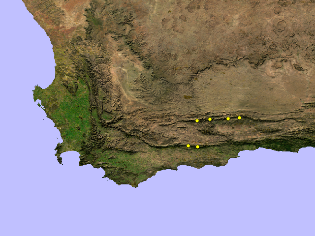
Although these maps show just one map output, they each represent a series of distribution maps, each with the same configurable style, extent and resolution.
Distribution Map Generator is available through the QGIS plugins registry: http://plugins.qgis.org/plugins/DistroMap/